The Fundamentals of Army Basic Training Map Reading
When we talk about army basic training map reading, we are talking about a skill set that has been the backbone of military operations since soldiers first scratched marks in the dirt to show the way. A military map is a graphic representation of a portion of the earth’s surface, drawn to scale, as seen from above. It uses colors, symbols, and contour lines to turn a flat piece of paper into a three-dimensional mental picture of the ground.
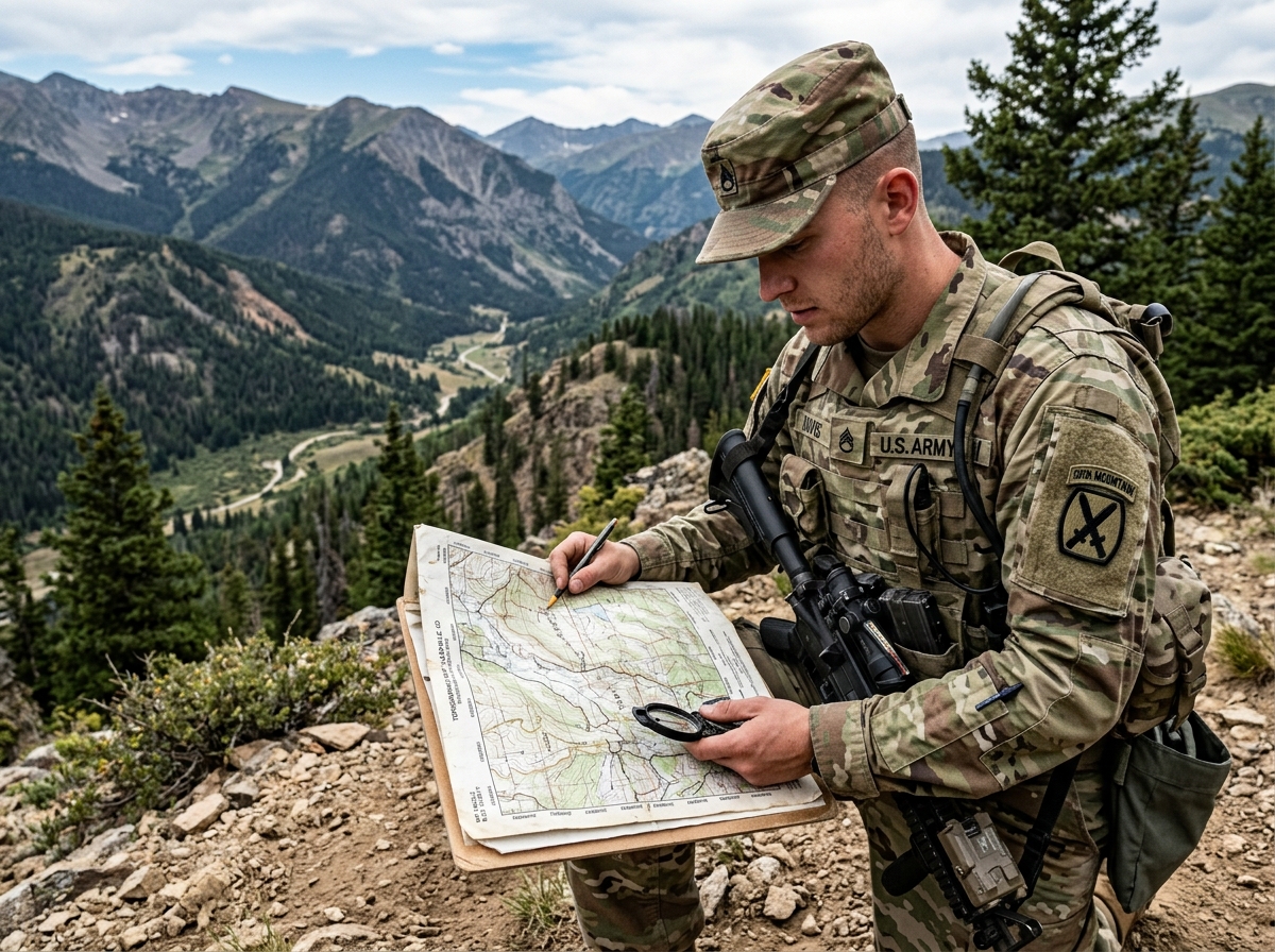
In recent years, many assumed that the Global Positioning System (GPS) had made paper maps obsolete. However, the Army has realized that over-reliance on digital tools is a massive vulnerability. In a “degraded environment”—where an adversary uses cyber warfare to jam satellite signals or where batteries simply die—a soldier who can’t read a map is effectively blind.
This is why the Army relies on doctrine like FM 3-25.26 Map Reading and Land Navigation to standardize training. Whether you are in the Active Component or the Army Reserve, these skills are considered “Army Warrior Tasks” that must be practiced regularly to maintain tactical proficiency. If you are preparing for the transition to military life, check out what you need to know about military basic training to see how these skills fit into the bigger picture.
Plotting Coordinates in Army Basic Training Map Reading
The first thing we learn in army basic training map reading is how to tell someone exactly where we are. The Army uses the Universal Transverse Mercator (UTM) grid system, which divides the world into 60 zones. On your map, this looks like a series of numbered vertical and horizontal lines forming squares.
The golden rule of map reading is: “Read Right, then Up.”
To find a coordinate, you start at the bottom-left of the map, move right along the horizontal numbers (easting), and then move up along the vertical numbers (northing). The number of digits you use determines how close you get to your target.
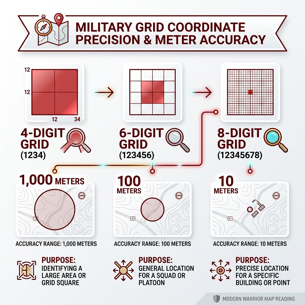
| Grid Digits | Accuracy Range | Purpose |
|---|---|---|
| 4-digit | 1,000 meters | Identifying a large area or grid square |
| 6-digit | 100 meters | General location for a squad or platoon |
| 8-digit | 10 meters | Precise location for a specific building or point |
| 10-digit | 1 meter | Scientific or highly technical precision |
In Basic Training, you will most commonly work with 6-digit and 8-digit grids. Using a military protractor, you’ll align the scale with the grid lines to pinpoint your “dot” on the map. It sounds simple, but doing it in the rain while you’re tired is where the real test begins!
The Importance of Traditional Navigation Over GPS
Why do we still stress over paper and ink? Because high-tech gadgets are fragile. During recent conflicts in Ukraine, we’ve seen how electronic warfare can render GPS-guided tools useless. If our junior leaders—the NCOs who are the “backbone of the Army”—can’t navigate without a screen, the mission fails.
The Army’s TC 3-25.26 (FM 3-25.26) Map Reading and Land Navigation manual emphasizes that traditional navigation builds a soldier’s “terrain association” skills. This is the ability to look at a map, look at a hill, and recognize they are the same thing. GPS tells you where you are, but map reading tells you what the ground is doing. That knowledge allows a leader to choose a route that offers cover from enemy fire, rather than just following a blue line on a screen that might lead them into an open field.
Essential Tools and Mechanics of Land Navigation
To navigate successfully, you need more than just a map. You need the “Big Three”: a map, a protractor, and a lensatic compass.
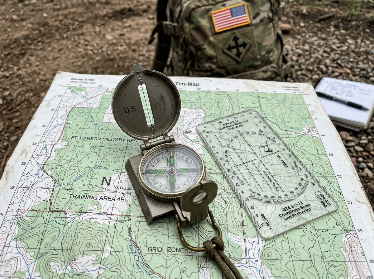
The lensatic compass is a marvel of military engineering. It consists of three major parts:
- The Cover: Protects the compass face and contains the sighting wire.
- The Base: Contains the floating dial and the bezel ring (which clicks—each click is 3 degrees).
- The Lens: Used to read the dial while sighting on an object.
In army basic training map reading, you’ll learn two primary ways to hold the compass. The centerhold technique is fast and works well while moving; you tuck your elbows into your sides and point the compass straight ahead. The compass-to-cheek technique is for maximum precision when you need to “shoot an azimuth” to a distant landmark. If you’re curious about other gear you’ll encounter, read more about what to expect at army boot camp.
Directional Movement with Azimuths
An azimuth is simply a horizontal angle measured clockwise from a north base line. But here is the catch: there are three “Norths” on a military map:
- True North: The North Pole.
- Magnetic North: Where your compass needle points.
- Grid North: The vertical lines on your map.
The difference between these is called the G-M Angle (Grid-Magnetic Angle). You must adjust your compass based on the “declination diagram” found in the map’s marginal information. If you forget to convert your azimuth from grid to magnetic, you could end up hundreds of meters off course.
We also use back azimuths to get home. If your azimuth to a target is 90 degrees, your back azimuth is 270 degrees. The rule is simple: if the number is less than 180, add 180. If it’s more than 180, subtract 180. It’s the military version of “U-turn.”
Tips for Success in Army Basic Training Map Reading
The most common reason soldiers fail land nav isn’t the map—it’s their feet. You must know your pace count. This is the number of natural paces (every time your left foot hits the ground) it takes you to walk 100 meters.
We recommend practicing your pace count on different terrains. You’ll walk faster on a road than you will through a swamp. Keeping a “bead” or “pace beads” on your gear helps you track how many hundreds of meters you’ve traveled so you don’t overshoot your objective.
Finally, you must HOW TO AVOID GETTING LOST by trusting your compass. Your brain will try to tell you that “the hill is that way,” but if the compass says otherwise, the compass is usually right. Maintain situational awareness by constantly checking landmarks (steering marks) against your map.
Identifying Terrain Features and Relief
Reading a map is like reading a story. The “relief”—the ups and downs of the Earth—is told through contour lines. These are the wavy brown lines that connect points of equal elevation. When the lines are close together, the ground is steep (like a cliff). When they are far apart, the ground is relatively flat.
To help recruits remember the features on a map, we use the “Hidden Valley Ranch” mnemonic for the five major terrain features and “DSC” for the minor ones. Mastering these is a huge part of how you survive basic training for great military jobs.
Major Terrain Features
- Hill: A point of high ground. On a map, it looks like concentric circles.
- Ridge: A sloping line of high ground.
- Valley: A stretch of low land between mountains or hills, usually with water flowing through it. Contour lines form a “U” or “V” shape pointing toward high ground.
- Saddle: A dip or low point between two areas of higher ground.
- Depression: A low point in the ground (a hole). These are marked with “tick marks” pointing inward toward the low spot.
Minor and Supplementary Features
- Draw: A less developed stream course than a valley. The “V” shape points toward high ground.
- Spur: A short, continuous sloping line of higher ground jutting out from the side of a ridge.
- Cliff: A vertical or near-vertical feature.
- Cut and Fill: Man-made features where the earth has been cut away (for a road) or piled up (for an embankment).
Navigating Day and Night: Challenges and Solutions
Day land navigation is usually about terrain association. You look at the map, see a ridge to your left and a stream to your right, and you know exactly where you are. Night navigation is a different beast entirely.
At night, the world looks different. You can’t see the ridge or the stream. This is where dead reckoning becomes your best friend. You set a precise azimuth on your compass (using the luminous marks on the dial) and follow your pace count religiously.
Success at night requires teamwork and extreme discipline. You move slower, check your compass more often, and try not to panic when the woods start looking the same in every direction. If you can master night nav, you’ve mastered the hardest part of army basic training map reading.
Overcoming Common Land Nav Obstacles
Even the best navigators make mistakes. The most common is a plotting error—putting your dot in the wrong place before you even leave the start point. Always double-check your coordinates!
Weather is another factor. Rain can turn your paper map into mush (unless you protect it) and wipe away your pencil marks. If you realize you are lost, the best thing to do is “re-orient.” Use intersection (finding an unknown point by using two known locations) or resection (finding your own location by sighting on two visible landmarks) to get back on track.
Frequently Asked Questions about Military Land Navigation
Why does the Army still teach map reading in the age of GPS?
GPS signals can be jammed by enemies, and electronic devices require batteries and clear views of the sky. Map reading is a “zero-fail” skill that works in any environment, ensuring soldiers can always find their way home regardless of technology.
What is the “Right and Up” rule for grid coordinates?
It is the standard method for reading military maps. You always read the numbers along the bottom (Left to Right) first, then the numbers along the side (Bottom to Top). This ensures everyone is looking at the same square on the grid.
How do I determine my pace count for 100 meters?
Find a measured 100-meter track. Walk it at a natural pace and count every time your left foot hits the ground. Do this multiple times—on flat ground, on a hill, and through brush—to get an average. Most people average between 60 and 70 paces.
Conclusion
At USMilitary.com, we know that the journey from civilian to soldier is filled with challenges, but mastering army basic training map reading is one of the most rewarding. It builds more than just a technical skill; it builds confidence, tactical readiness, and leadership.
When you can stand in the middle of a dark forest with nothing but a compass and a map and know exactly where you are, you’ve transitioned from someone who follows to someone who leads. This proficiency is a prerequisite for career progression, from the Basic Leader Course to elite schools like Ranger or Special Forces.
If you’re ready to take the first step toward your military career and put these skills to the test, Explore Army Basic Training Opportunities today. The path is mapped out—you just have to follow the azimuth.
Free for Service Members & Veterans
Get the military benefits intel no one tells you about.
Weekly updates on VA benefits, pay changes, and money tips — free for service members and veterans.
No spam. Unsubscribe anytime. Your info is never shared.